POLYCHROMA
SCHRITT 1
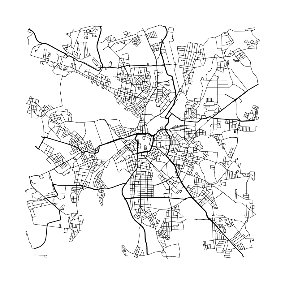
Sammlung der Straßendaten
Um die Basis für unsere Kunstwerke zu schaffen, beginnen wir mit dem Sammeln von Straßendaten, die die Grundadern unserer Stadtpläne bilden. Diese Daten beziehen wir von OpenStreetMap (OSM) mittels der Overpass API, einer leistungsstarken Datenabfrageplattform, die es ermöglicht, spezifische Informationen über Straßenverläufe in jeder gewünschten Region zu extrahieren. Die Präzision und Aktualität der OSM-Daten ermöglichen es, ein detailliertes und authentisches Straßennetz zu erzeugen.
SCHRITT 2
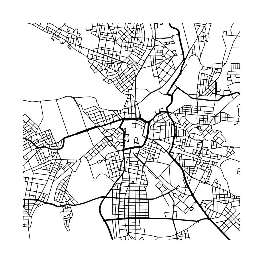
Bereinigung der Daten
Nachdem wir alle Straßendaten gesammelt haben, folgt die Phase der Datenbereinigung und Verarbeitung. In diesem Schritt setzen wir verschiedene Algorithmen ein, um Unstimmigkeiten zu beseitigen, wie zum Beispiel 'Dangles' – das sind Sackgassen oder nicht verbundene Enden im Straßennetz – und entfernen alle unerwünschten Elemente. Dies stellt sicher, dass nur die relevanten Daten für die nächste Phase des Schaffensprozesses übrig bleiben.
SCHRITT 3
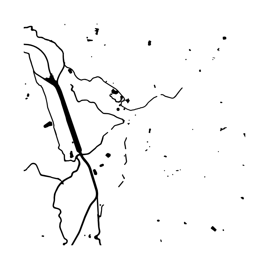
Wasserdetails
Nach der Datenbereinigung fahren wir mit der Integration der Wasserkörper fort. Hierzu extrahieren wir alle relevanten Daten zu Flüssen, Seen und weiteren Gewässern ebenfalls aus der Overpass API. Diese Informationen werden mit den Straßendaten verschmolzen, was zu einem komplexen Netz aus Straßen und Wasserwegen führt – einem 'Spinnennetz', das die urbanen und natürlichen Adern der Landschaft illustriert. Diese Verschmelzung ist entscheidend, um das Zusammenspiel zwischen den von Menschen geschaffenen und natürlichen Strukturen zu visualisieren.
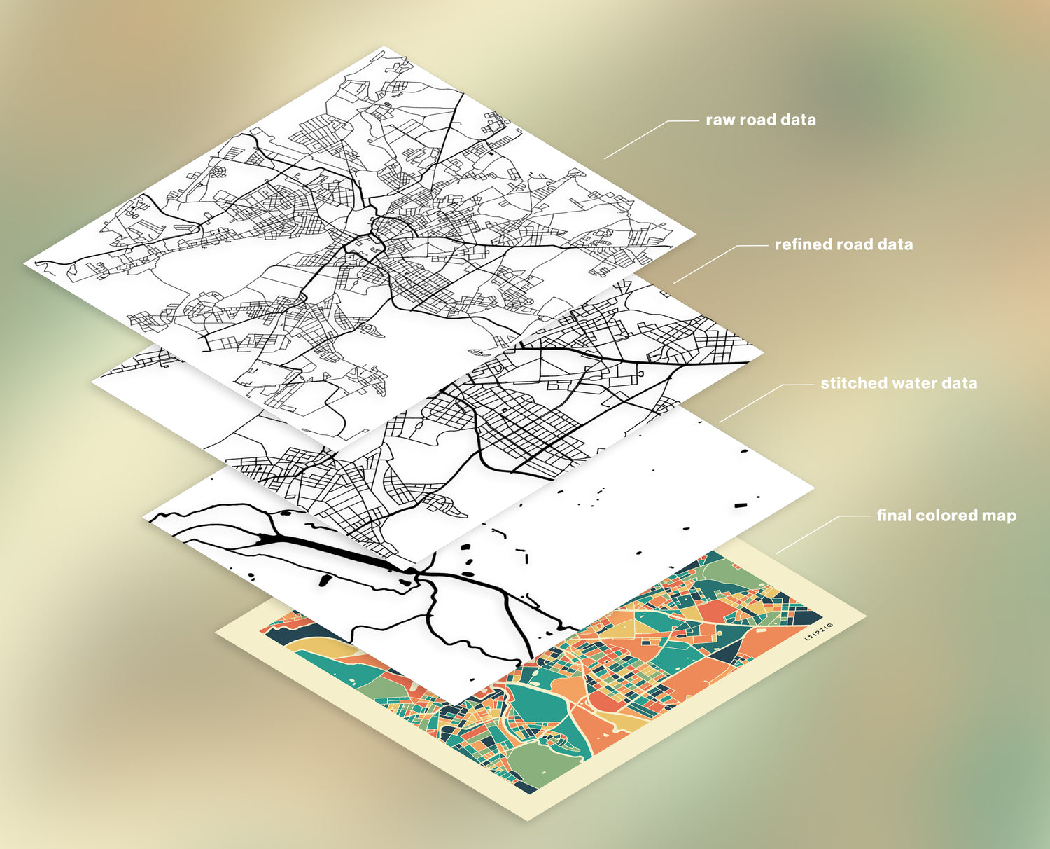
SCHRITT 4
Das Finale
Der finale Schritt in unserem Schaffensprozess ist der Abzug des kombinierten Straßen- und Wassernetzes von einer definierten Landmasse. Dieser Prozess trennt die unterschiedlichen Bereiche und formt vielfältige Polygone. Jedes dieser Polygone stellt einen individuellen Bereich dar, den wir anschließend einfärben. Für die Farben verwenden wir eine vordefinierte Palette von acht festgelegten Farben, um eine harmonische, aber zugleich zufällige Farbgebung zu erzielen. Das Ergebnis ist ein abstraktes, farbenfrohes Kunstwerk, das die Einzigartigkeit der urbanen Landschaft einfängt.
-
Stuttgart Colorful Retro Map Poster Print
Regular price From €22,99 EURRegular priceUnit price per -
São Paulo Colorful Retro Map Poster Print
Regular price From €22,99 EURRegular priceUnit price per -
Hamburg Colorful Retro Map Poster Print
Regular price From €22,99 EURRegular priceUnit price per -
London Colorful Retro Map Poster Print
Regular price From €22,99 EURRegular priceUnit price per


